Séléa
Séléa Bambao, the village of Selea-Bambo, is situated in the Bambao region in Grande Comore. Bambao is a well-known region of Grande Comore, and it contains the largest region of the Grande Comore. The capital of Grande Comore, Moroni, is located in the Bambao region.
Bambao, also referred to as Bambao Mtrouni, consists of sixteen villages. The villages lie linearly along the sea, as well as in the mountainous regions. Most of Bambao is rural and comprises farmland and forest. However, deforestation of the land for housing threatens the local environment.
Near the center of the isle lies Mount Karthala which stands over 7700 ft tall.
Grande Comore has an area of 443 mi2. The northern area of the island (two thirds) is dominated by rocky plains also known as La Grille.
Selea-Bambao is relatively small with a population of around 4500 inhabitants.
Map - Séléa
Map
Country - Comoros
 |
 |
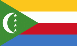
| Flag of the Comoros | |
The sovereign state consists of three major islands and numerous smaller islands, all of the volcanic Comoro Islands with the exception of Mayotte. Mayotte voted against independence from France in a referendum in 1974, and continues to be administered by France as an overseas department. France has vetoed United Nations Security Council resolutions that would affirm Comorian sovereignty over the island. Mayotte became an overseas department and a region of France in 2011 following a referendum which was passed overwhelmingly.
Currency / Language
| ISO | Currency | Symbol | Significant figures |
|---|---|---|---|
| KMF | Comoro franc | Fr | 0 |
| ISO | Language |
|---|---|
| AR | Arabic language |
| FR | French language |


